Drones are revolutionizing various industries, including logistics, agriculture, and cinematography, among others. They offer unparalleled flexibility, cost-effectiveness, and efficiency in completing tasks that would otherwise be difficult or impossible to achieve with traditional methods. However, with the increasing use of drones, there are growing concerns about safety and security, especially in areas where drone flights are restricted. For example, near airports, military bases, government buildings, and other sensitive areas. Violating these restrictions can result in severe consequences, including fines, legal action, or even endangering lives. Therefore, it is essential to have robust safety measures in place to ensure compliance with standards, such as Eurocae ED-269 and ED-270, and prevent accidents. This is where Veronte’s Geofencing technology comes in.
Veronte Autopilot allows drone operators to configure restricted areas thanks to its new geofencing capabilities
Veronte autopilot allows drone operators to configure restricted areas or volumes as polygons or circles, thanks to its new Geofencing capabilities. This feature offers an easy-to-use interface, the VeronteOps tool, allowing drone operators to set up restricted flight areas quickly and effectively. This tool shows the restricted areas in the map with a shade of red. Any attempt to enter these areas will result in an automatic detour of the aircraft to prevent going into those areas and then it will continue with the planned route. Moreover, Veronte Autopilot’s Geocaging capabilities allows to delimit Safe Flight Areas, to delimit zones from which the drone cannot leave. In addition, the Veronte autopilot enables drone operators to update restricted flight areas even during flight, making it a versatile and efficient solution for managing restricted areas. All in compliance with Eurocae ED-269 and ED-270.
Geofencing can be used also to bing the operation of the UAV’s in altitude, for example configuring a minimum or/and maximum height in certain areas.
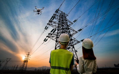
Furthermore, Veronte’s Geofencing technology has multiple applications beyond regulatory compliance. For instance, it can be used for precision agriculture, where drones can be programmed to avoid restricted areas such as water sources, crops, or livestock. This helps prevent any potential damage to crops or livestock and ensures that the drone stays on course to complete the mission. It can be also used to prevent going too close to electric lines, wind turbines, etc.
Overall, Veronte’s Geofencing technology is a valuable tool for drone operators, enabling them to comply with regulations such as the Eurocae ED-269 and ED-270 standard, prevent accidents, and protect sensitive infrastructure. Its easy-to-use interface, versatile features, and advanced capabilities make it an ideal solution for a wide range of applications. Whether you are a drone operator in the logistics, military, agriculture, or cinematography industry, Veronte’s geofencing technology offers unparalleled control and stability, ensuring the safe and responsible operation of your drone.


0 Comments